
Topographische USA-Karten
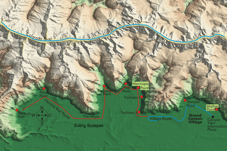
Grand Canyon National Park Südrand, westlicher Teil (Westrim)
Topographische Karte des westlichen Teils (West Rim) vom Südrand des Grand Canyon National Parks in Arizona basierend auf digtalen Geländemodellen (.dem) des United States Geological Survey.
Index aller USA-Karten.
Topographic map the western part of Grand Canyon National Park South Rim (West Rim) in Arizona based on the digital elevation model (.dem) of the United States Geological Survey.
Index of all USA maps.
Für ausführliche Reiseinformationen zum Grand Canyon NP blättern Sie durch den Online-Reiseführer
Viele nützliche Phototipps und Motivhinweise zum Grand Canyon finden Sie im PhotoFührer USA Nordarizona.